Burdekin Major Integrated Project — Gully Maintenance and Monitoring at THREE MILE
Long diversion bank to divert and trap damaging water flow
The site
(Completed 2020)
Earth works were aimed at halting the progress of a linear hillslope gully, about 15m wide and 0.8m deep, consisting of a series of actively eroding gullies.
Remediation involved the construction of a 250m long diversion bank and a 20m water spreading structure at the outlet of the bank.
The area between the diversion bank and the gullied area was contour ripped to help manage surface runoff feeding the gully. Earthworks took four days to complete.
The reshaped gully and immediate surrounds was treated with topsoil and seeded with pasture varieties.
A new fence has been constructed to manage stock access to the site.
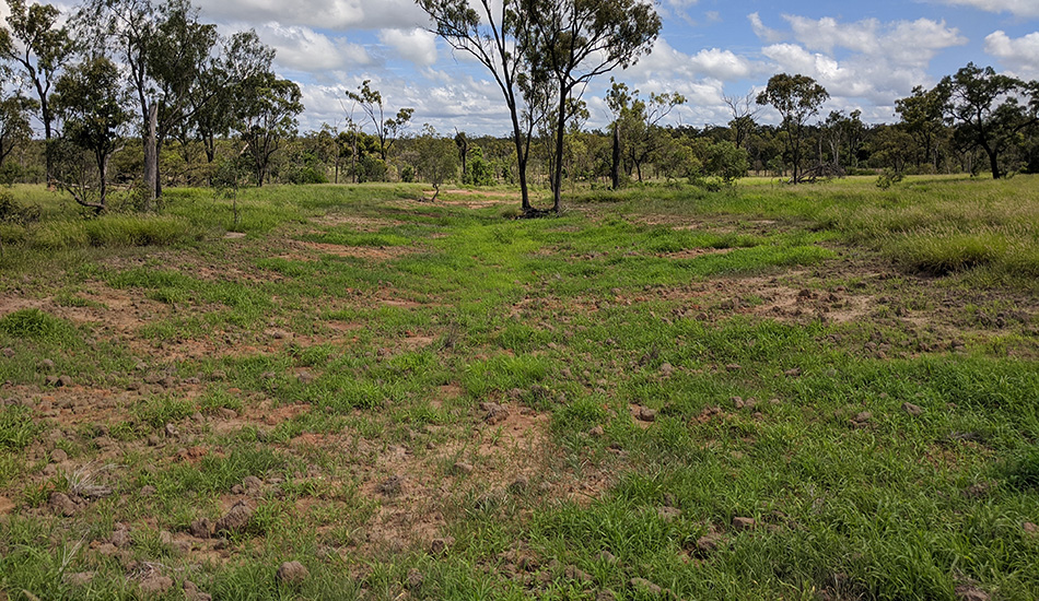
The site after earthworks were completed, then transformed by rain into new land that would, with careful management, be productive land again. Hover the cursor over the image to toggle between BEFORE and AFTER images.
Landholder observations
Remediation benefits
- Remediation of erosion features has reduced soil erosion and sediment entering the local waterway.
- Paddock water infiltration and surface water management has improved.
- Groundcover in, around and above the erosion features has improved.
- Need to consider input costs because being a smaller property and business (258ha), planning considerations must be taken into account.
Grazing land management
- Light stocking rate is aiding improvement of land condition. The neighbouring property is managed by his son-in-law, Barry Collett, stock is moved between the two properties for short intensive graze periods.
- Grazing may be implemented by way of repeated short duration grazes, particularly during the growing season, however it’s based on forage availability.
- The long-term aim is to gain grazing land and to restore land function.

Carl Groocock… all smiles about stopping an actively-eroding gully, regaining land as well as improving surface water management and infiltration rates across the paddock.

NQ Dry Tropics Soil Conservation Officer Bernie Claussen with Three Mile grazier Carl Groocock checking on the progress of vegetation in the paddock since the earthworks were completed.
Monitoring
The site is being monitored to evaluate effectiveness of treatment.
It’s monitored each year in the post wet season (April-July).
Site monitoring applies industry standard tools Land Condition Assessment Tool advanced (LCAT) and Gully Maintenance Tool (GMT). These tools enable finer scale changes to be measured over time.
- Land Condition Assessment Tool advanced (LCAT).
A minimum of two LCATS are carried out immediately upslope of the gully, in the base of the rehabilitated gully, and opportunistically depending on local conditions. LCATs indicate many biophysical aspects demonstrating the process of gully stabilisation. - Gully Maintenance Tool (GMT)
GMT surveys take into account a range of biophysical elements including gully head movement, treatment type, treatment stability, ground cover and composition, species, rainfall, and photopoints targeting key gully and erosion features.
Landholder feedback about stocking data and environmental influences such as rainfall is also collected.